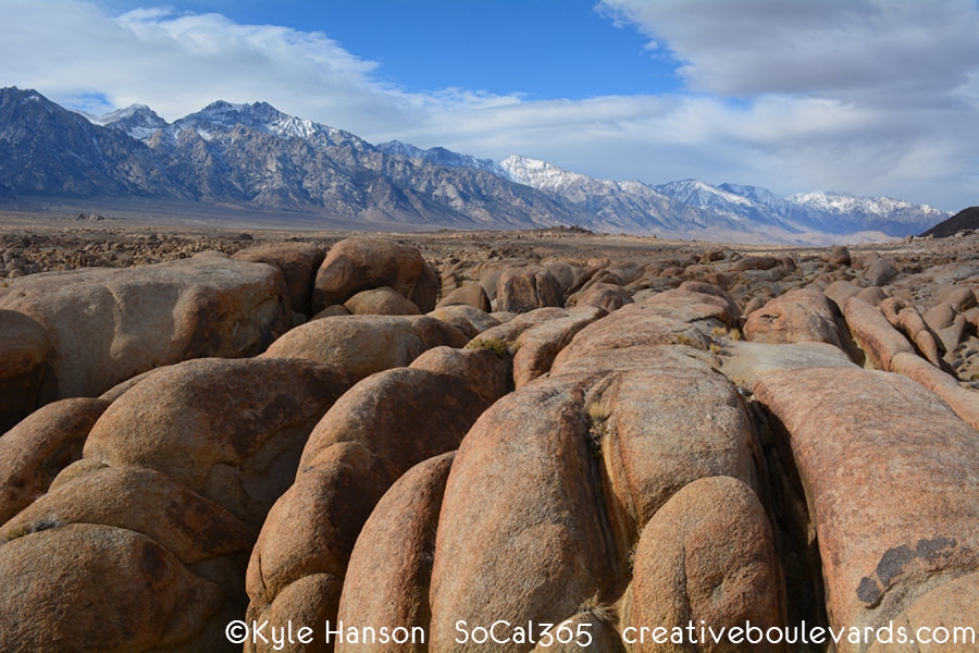
#364 Alabama Hills
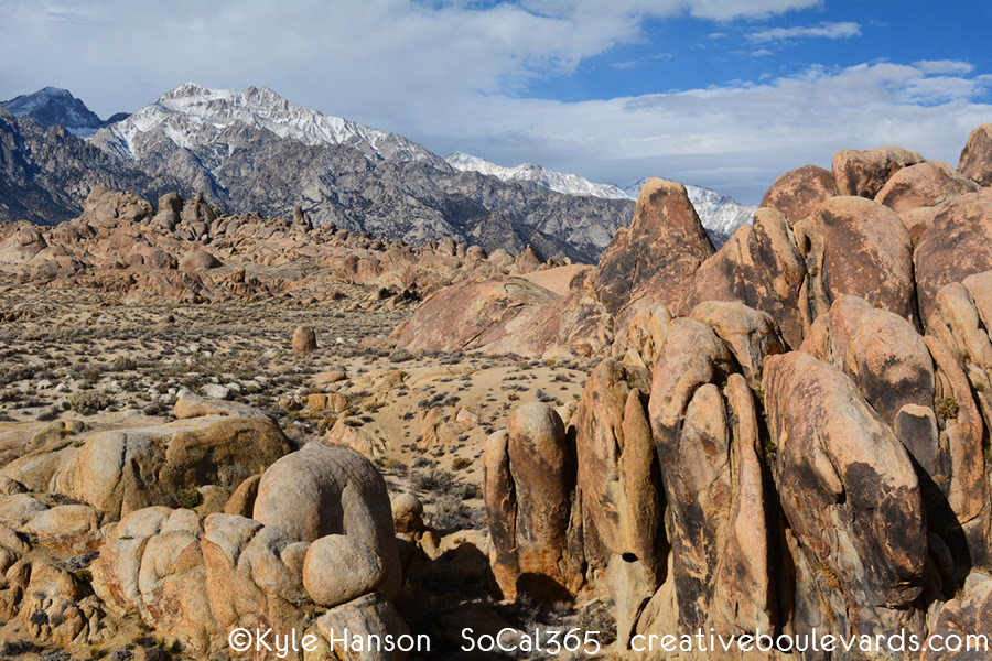
The Alabama Hills Recreation Area is a stunning mirage of rocks and hills in the Eastern Sierra Nevada. Metamorphosed volcanic rock up to 300 million years old as well as biotite monzogranite up to 85 million years old create the wondrous assortment of shapes and arches. Hiking, photography and stargazing are some of the best ways to enjoy the land. Many films were shot here since the 1920's including 'How the West Was Won' and 'The Lone Ranger'. A scenic drive along Movie Flat Road will take you to exact locations for famous film scenes.

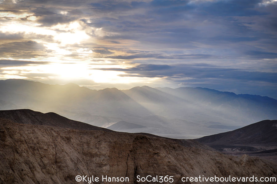
#348 Dante's View

Dante's View is the best place to admire the expansive view of Death Valley. At 5,475 feet, the vista sits on the crest of the Black Mountains and looks to the Valley, Panamint Range and Badwater Basin with its white salt flats. On a clear day, the highest point in the contiguous United States, Mount Whitney (14,494 feet) can be seen alongside the lowest point Badwater (-282 feet).


#320 Zabriskie Point

Zabriskie Point is a must-see stop in Death Valley National Park. Its colorful badlands and erosional cliffs started forming 5 million years ago from an ancient lakebed. The vista was named after Christian Brevoort Zabriskie, manager of the famous Pacific Coast Borax Company. A short walk will bring you to the top of the lookout: the best in the wild west.

#308 Carrizo Plain National Monument

Carrizo Plain National Monument is a true wilderness experience in California's Great Central Valley. More than 200,000 acres of untouched beauty reveal what the entire valley looked like long before development. Beautiful grassland plains hug rolling hills blanketed by a rainbow of wildflowers in the Spring. The San Andreas Fault cuts right through the plain giving it a rich geological history. Native Chumash considered the plain sacred and inhabited the area for at least 4,000 years.
Today, this is the only original California grassland strand remaining. The highest concentration of endangered species in the state reside here including the tule elk, pronghorn, San Joaquin kit fox & antelope squirrel, blunt-nosed leopard lizard, giant kangaroo rat as well as the California condor. Managed by the Bureau of Land Management as opposed to the National Park Service, the plain is continuously in a controversial debate over grazing, solar power and oil drilling rights. One visit will have you one the side for preservation.
*Access is dirt road only, 4 wheel drive strongly recommended

#280 Artist's Drive & Palette

Artist's Drive & Palette is a deep canyon in the Black Mountains of Death Valley National Park. Oxidation of metals along the canyon walls create a rainbow of colors from iron, mica and manganese exposed from volcanic activity. This one-way 9-mile drive provides stunning vistas at every turn and is best seen in the afternoon light and sunset where the colors are their most vibrant.

#276 Santa Barbara Museum of Natural History

The Santa Barbara Museum of Natural History is my favorite museum in Southern California and has been around since 1916. The museum beautifully showcases the surroundings of Santa Barbara from the Native American Chumash, bird & mammal halls as well as marine and plant life. The beautiful grounds run along Mission Creek. With 3.5 million specimens in its extensive collection, there is something to delight everyone during its Centennial Celebration.


#274 Wonderland of Rocks

Wonderland of Rocks features 12 square miles of amazing granite rock formations at Joshua Tree National Park. These monzogranite rocks formed 100 million years ago when molten liquid heated and traveled up from the Earth's crust. As the landscape changed to desert, flash floods caused the ground to wash away exposing rocks that piled into stacks of fascinating arrangements. This wonderland can be accessed from Barker Dam and Indian Cove trails.

#255 Ubehebe Crater

Ubehebe Crater is a half mile length volcanic crater in Death Valley National Park. It was created by a steam and gas explosion caused by rising magma touching ground water. Research has estimated it could have occurred less than 1,000 years ago making it very young in geologic terms. Timbisha Shoshone Native Americans called the crater 'Tem-pin-tta- Wo’sah' which translates to 'coyote's basket'.

#239 Rainbow Basin Natural Area

Rainbow Basin is a National Natural Landmark in the Mojave Desert outside of Barstow. Its geological rock formations include a mirage of brilliant colors. The basin is also a rich fossil bed with findings of horses, camels and even flamingos! Enjoy a trip through time in this untouched landscape. A one way dirt road winds through the scenic canyons. *4 wheel drive recommended


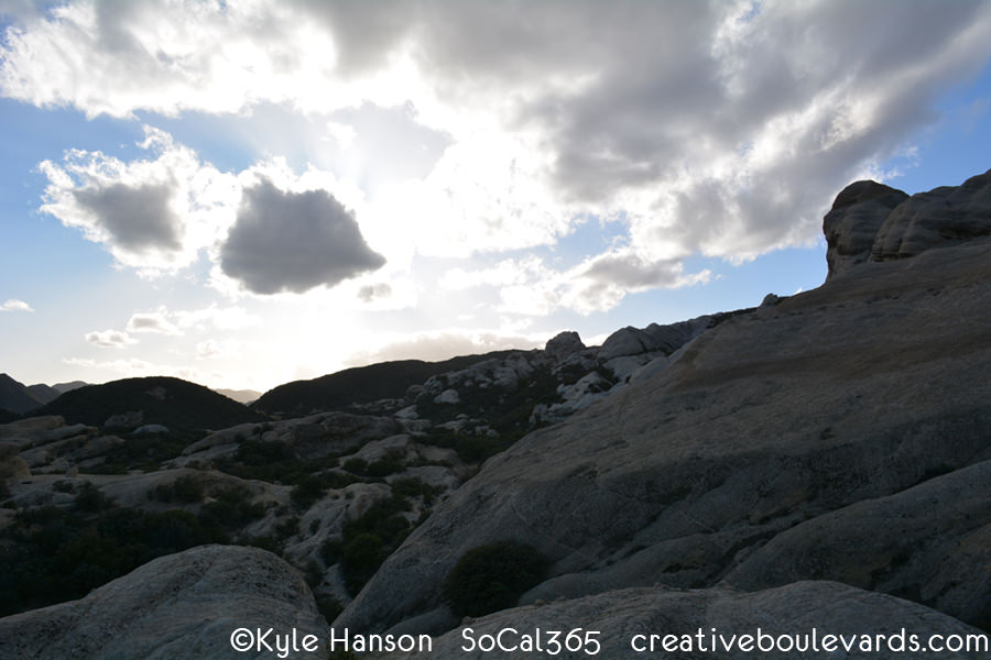
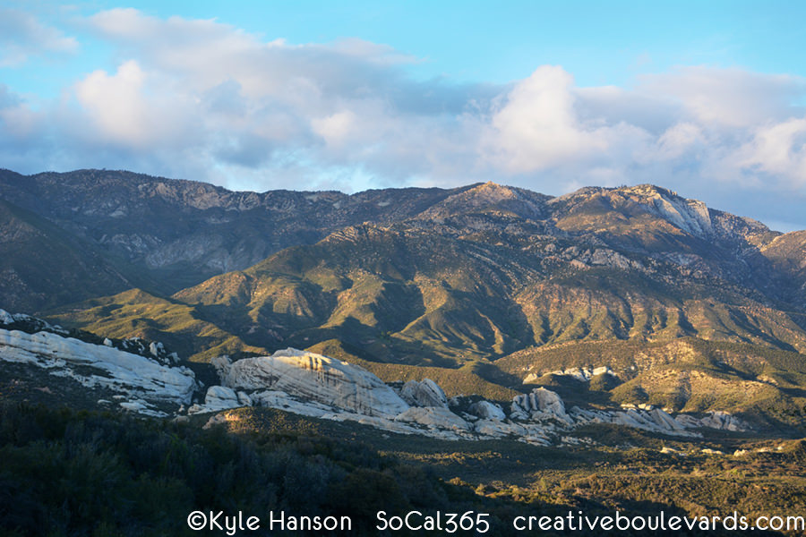
#234 Piedra Blanca

Piedra Blanca, meaning white rock in Spanish, are a series of geological rock formations in Los Padres National Forest. The Gene-Marshall Piedra Blanca National Recreation Trail takes you just over a mile each way to the site. After crossing the Sespe Creek, the white rocks appear and create a stark contrast to the surrounding forest.